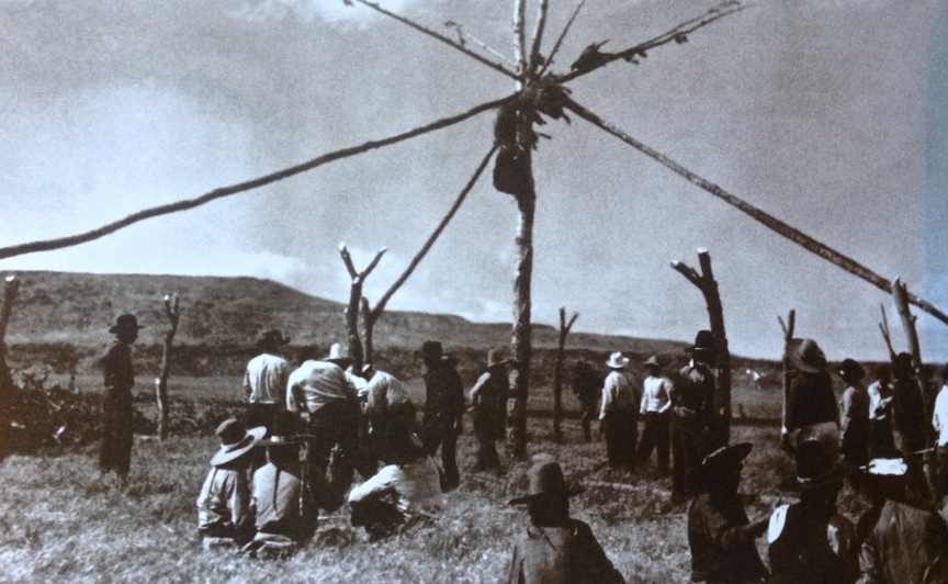
The approximate location of Whitestone Hill.
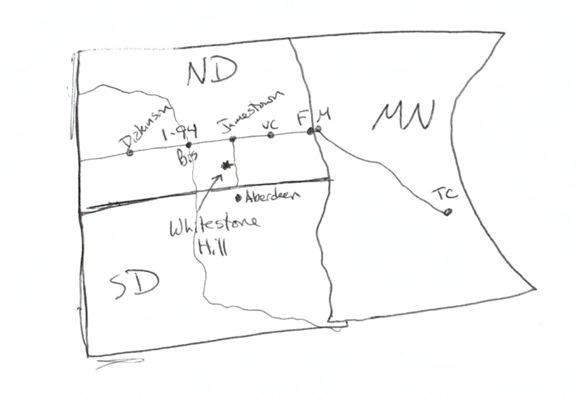
I’ve decided that very few people know the location of Whitestone Hill in southeastern North Dakota. This decision came to me after hearing the “Where is that?” response to my remark, “Whitestone Hill…” It is now 2013. This location, Whitestone Hill, is important since it is a site where the U.S. Army brought total war to a domestic encampment of northern Great Plains indigenes in early September of 1863. We are almost upon the 150th year of remembrance. So we need to make ourselves more aware of these sites, primarily because our history — whether we know or like it or not — informs us about how things are today. It is also the stuff that disparate groups identify with. This is why we sometimes hear things like, “History is about identity.” This is true. If we don’t know about Whitestone Hill, then we don’t know why things are the way they are today.
So people can more readily find Whitestone Hill, over the lunch hour I decided to scribble out a map, and also scan a DeLorme topo map of the location specifics. I’m blogging about it now, and I figure that if folks ask me, “Where is that?” instead of me gesturing in the air about the relative location of Whitestone Hill to Jamestown, Aberdeen, Edgeley or Ellendale, I can just send them this link. Above is a rough sketch of the approximate location of Whitestone Hill that I prepared while eating squash and cauliflower curry soup over the lunch hour.

A DeLorme map of the Whitestone Hill location.
If you’re on Eisenhower’s Interstate 94, just head south from Jamestown, North Dakota on Highway 281. If you’re in Aberdeen, South Dakota, head north on Highway 281.
If coming from Jamestown, drive about 40 or 50 minutes south until you hit Edgeley, North Dakota. From Edgeley, head west on ND Highway 13, and this eventually turns into south-bound Highway 56. Travel south of Kulm about 10 or 11 miles to 88th Street SE. Travel east on 88th Street SE for four miles, and then turn north (by this point you’ll see “Whitestone Hill” signage to direct you to the site).
If coming from Aberdeen, South Dakota, drive north to Ellendale, North Dakota, and head west on ND Highway 11. Travel west on Hwy 11 for about 20 miles, and turn north onto ND Highway 56. Drive 10 miles north on Highway 56, and turn east on to 88th Street SE. Drive the four miles east, and turn north at the Whitestone Hill signage.
Note: even though the signage on the DeLorme map reads “Battlefield,” and even though during your approach you will start seeing “Whitestone Hill Battlefield” signage, do not be tempted to call it that unless you are ready to define what is meant by that. Even then, it is not a good idea.