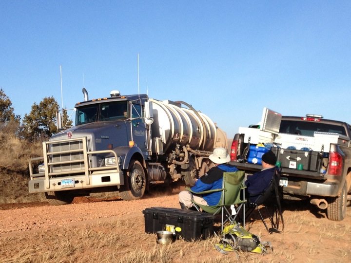
Right now, as I type, Richard Rothaus is delivering a presentation at the annual Preservation North Dakota meeting. This is taking place at Richardton Abbey just off of I-94 in western North Dakota. Rothaus is speaking about the Adventure Science operation that took place in western North Dakota in late-April 2013. A couple weeks before he and Andrew Reinhard headed out, Rothaus texted and asked if I wanted to provide a kind of mobile base camp support. Because at the time I was bogged down with readings and technical reports I said “Yes, of course.” It turns out that providing mobile base camp support for an Adventure Science project on the death highway (85) in the industrial petroleum play land of western North Dakota also allows a person to get a good back-logged chunk of reading in.

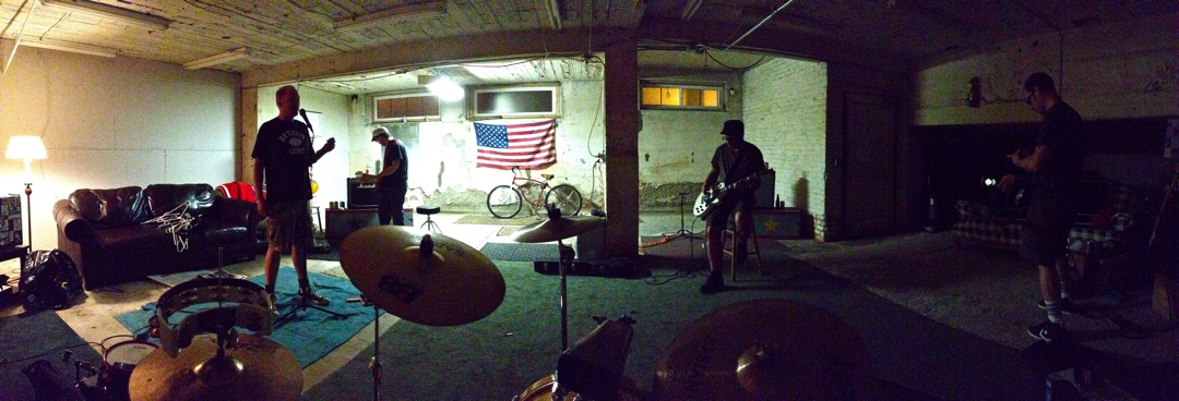
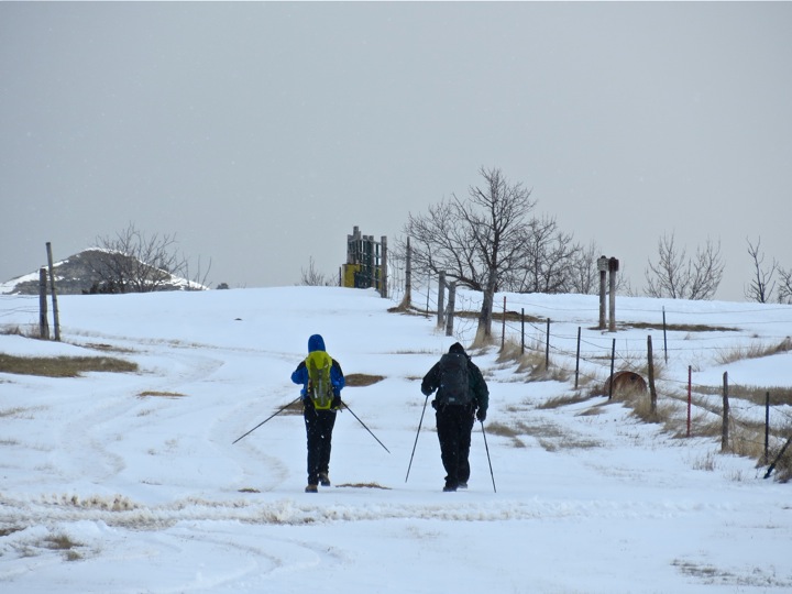
Andrew Reinhard on the morning of April 22, 2013.
Anyhow, it was later decided by Reinhard, Rothaus and I that after the first day of the Adventure Science outing, perhaps the best understanding of how things almost went to hell was captured by the exchange of text messages between the three of us. Some quick context: spring was increasingly realized, although by late April 2013, winter still held the evenings, nights and mornings. This meant that everything would freeze at night (the ground included), giving overland trekking crews a solid footing in the morning. By mid-morning the sun would warm the ground enough to thaw everything, enough so I had to move the truck off a dirt two track on to solid asphalt because it started sliding from a stationary position due to the melt. This proved to be highly educational to Rothaus and Reinhard who were completing the first leg of the project: they slid down from the finger-ridge buttes, and found it nearly impossible to climb up the slippery slopes. They restructured the way they would approach the routes.
But back to the text exchange between the three of us. As evening gave way to the setting sun and night, I started becoming really concerned. Reinhard and Rothaus had wet clothes from the day’s hike, and to overnight in below-freezing temps would be a certain dance with hypothermia. That would be bad. So I started sending off text-messages to them. On April 22, 2013, just off Highway 85 north of Grassy Butte, North Dakota, the text-exchange went something like this:

Reinhard and Richard Rothaus start the overland Adventure Science trek on the morning of April 22, 2013 in western North Dakota.
4:08PM, Rothaus to Barth: “We are in mud hell. This will take awhile. Hang tight. Could take till 7 or 8.”
Barth to Rothaus: “Okay. I’ll sit tight.” I somewhat jokingly added, “Let me know when I should call the National Guard.”
6:38PM, Rothaus to Barth: “We are up on a plateau heading toward 85. Will come out south of you. HAng tight. We are beat but good.”
Barth to Rothaus: “Okay. Good to hear. Can you see 85 from your locale?”
Rothaus to Barth: “No. But we are getting there. Andrew [Reinhard] is solid. I am short on oxygen. So no serious worries.”
6:50PM, Rothaus to Barth and Reinhard: “We will come out about a mile south. We are probably 2 it less to road. Still could be mud.”
Barth to Rothaus and Reinhard: “Okay. Tell me when you get to road. I will come pick you up. Would it be wise to hotel it for one more night? I’m fine either way. If yea, let me know and I will book rooms. 16 [F] tonight. 18 [F] tomorrow night.”
Reinhard to Rothaus and Barth: “I defer to richard. Almost at the rim. See you at 8:00.”
Barth to Reinhard and Rothaus: “Okay.”
7:36PM, Reinhard to Barth: “Barth: we can see 85 but it will take at least 2 more hours. Can you book 2 hotel rooms? This is crazy country.”
Barth to Reinhard: “Yup.”
8:05PM, Barth to Reinhard and Rothaus: “We’re back at the Quality Inn tonight!”
8:47PM, Barth to Reinhard and Rothaus: “Are you two walking together? Or is it going to be more like midnight when you get to the road?”
9:02PM, Reinhard to Barth and Rothaus: “We are together. Now on a ranch road so 1/2 mile easy walk. I think i see your truck. Move it forward ten feet so I can confirm. Tonight you drink all the beers… Saw you!!! We will come out there.”
Barth to Reinhard and Rothaus: “You south or north of me? Okay.”
Reinhard to Barth: “(I think)”
Barth to Reinhard and Rothaus: “It’s not as though I was looking up the number for the sheriff or anything.” You south or north of the truck?”
9:18PM, Barth to Reinhard and Rothaus: “The sun sets in teh west, so north is to your right, and south to your left.”
9:32PM, Reinhard to Barth: “South now I think. Maybe 1/4 mile? I am 100 feet og the road in the grass. I lost the ranch road. And Richard. He should head W to the road.”
Barth to Reinhard: “Can you both see me? WTF?”

The April 22, 2013 sunset in western North Dakota. Taken on Highway 85, just north of Grassy Butte.
Reinhard to Barth: “I will try to find a road sign. I am by a yellow road sign that is on southbound side indicating road turns to left. I will walk north to where i think i saw your truck until i see a mile marker”
Barth to Reinhard: “Okay. I turned on the roof light. Just get to 85 first.”
Reinhard to Barth: “Kk richard is headlampinf so i can meet him, i will look for your light too”
Barth to Reinhard: “Okay.”
Reinhard to Barth: “I see richard”
Barth to Reinhard: “Okay good. You guys see traffic on 85?”
9:45PM, Reinhard to Barth: “Line of 6 vehicles just passed northbnd.”
Barth to Reinhard: “Did a solo semi just pass? I’m gonna go back and forth on this road a couple times till you see me. Top light is on.”
Reinhard: “Yeah. Waiting on richard. Maybe 1,000 ft to go for him. Orange? I see yoy. I am .200 ft n of uou. Stop. We will come to you”
Barth to Reinhard: “Sounds good.”
Within a minute Rothaus and Reinhard were back at the truck. Temps were below freezing by this point, and they were exhausted. We drove back to Dickinson that night, and had a late-late dinner at Perkins.
One more note, and some unsolicited advice for policy planners, upper and lower level politicians, and so on: if you do not physically live and work in the Bakken and plan on visiting, and if you want a true cross section of it, don’t do it in an airplane. Take the same roads that the rest of us take. Go in the winter. And then do it again in the summer. Stay for at least a week, and spend a couple nights in a crew camp, and a couple nights in a hotel. Even grab a cup of coffee and watch semi-tractor trailer activity, too. You’re not going to be able to understand what goes on out in the Bakken unless you do this. A person is able to experience and understand a lot more with boots-on-the-ground than they are at 5,000 or 10,000 feet.


