Monthly Archives: April 2013

Real, Surreal, Romantic, and Wilderness

Last week while tooling around with and providing basecamp support for Richard Rothaus, Andrew Reinhard, and Adventure Science in the badlands and above the Bakken oil patch in western North Dakota, one of the evening camp sites we occupied was located in the National Grasslands. Starting on the evening of April 25, 2013, a Thursday, and ending on the morning of April 26, 2013, a Friday, I noticed that over the course of about 10 hours, depending on the direction one looked and at what time of day, the spot of our camp site was on a borderland between the city and the country, the petroleum industry and the grassland wilderness.

Reinhard ultimately found the place we would camp that night, this on one of the thousands of finger-ridge buttes that the badlands offers. On the butte of our campsite (about 15 to 20 miles west of Grassy Butte, North Dakota), short trees and shrubbery protected our spot from any potential winds that would come out of the west and north, and just a bit to the east. A larger butte to the south would provide additional wind break. A raised and ditched scoria/clinker road wrapped around this larger butte, and like most of these roads, it was made sturdy enough for semi tractor trailer traffic.

Below are photos arranged in chronological order, and this speaks to how the surreal and romantic, the wilderness and industry, all intersect at one particular location, and all in less than half a day.

Photo of evening campsite, looking north, tent at bottom-center.

Photo of evening campsite, looking north, tent at bottom-center.


Just as the sun dips down and sets in the west behind the badlands buttes.

Just as the sun dips down and sets in the west behind the badland buttes.

Andrew Reinhard at left has Richard Rothaus go over his photos from another 10+ mile leg of Adventure Science's 100 miles of North Dakota Wild.

Photo looking to the north. Andrew Reinhard at left has Richard Rothaus at right go over his photos from another 10+ mile leg of Adventure Science’s 100 miles of North Dakota Wild.

Not long after the sun set in the west, I looked to the east and saw this moon rising.

Not long after the sun set in the west, I looked to the east and saw this moon rising.

While the moon was low in the sky, it looked like this, with serious camera zoom.

While the moon was low in the sky, it looked like this, with serious camera zoom.

An hour or two later, when the moon got much higher in the sky, it looked like this.

An hour or two later, when the moon got much higher in the sky, it looked like this.

Just as the sun starts to rise, the petroleum industry returns.

Just as the sun starts to rise, the petroleum industry returns. This photo is from our National Grasslands campsite, early morning, facing south.

Eventually one embraces the industrial surreal and absurd, and begins to make morning coffee, while smiling.

Eventually one embraces the industrial surreal and absurd, and begins to make morning coffee while smiling. This photo is from the campsite, facing south toward the scoria/clinker road and taller butte.

After the coffee is made, chairs were set up along the roadside to take in the industrial sounds of a morning in western North Dakota.

After the coffee was made, chairs were set up along the roadside to take in the industrial sounds of a morning in western North Dakota. This photo is from the campsite, facing west-southwest.

More industry, or Leo Marx's idea and reality of that machine in the garden. I like to think of it more as an industrial playground in our family livingroom.

More industry, or Leo Marx’s idea and reality of that machine in the garden. I like to think of it more as an industrial playground in our North Dakota livingroom.

It is 1.5 trailers of industrial semi.

1.5 trailers of industrial semi.


Notes from the Basecamp (04/23/2013)

Basecamp water wagon and supplies.

Basecamp water wagon and supplies.

On April 4, 2013, Richard Rothaus and I chatted via e-mail about some base camp logistics for Adventure Science’s 100 miles of North Dakota wild, a pedestrian overland trek through ephemeral drainages and butte plateaus in the nation’s #2-producing oil field that is western North Dakota. We came to the conclusion that I could 1) be useful and helpful in coordinating points of drop off and extraction, and evening details for Rothaus and Andrew Reinhard; and 2) in the interim, between dropping off the team and setting up camp, I could read for comprehensive exams (also known as “comps”). On the April 21, 2013 drive out to western North Dakota, I also thought it would be a good idea to capture some traffic samples that are part and parcel to the borderline anarchy of any blossoming petroleum industry throughout the planet.

After dropping off Rothaus and Reinhard yesterday (04/22/2013) morning, I drove the field vehicle around to where they would arrive that evening, and set to reading for comps (“comps” is one part of the intellectual bootcamp, or disciplinary training, when working on a doctor of philosophy, in my case with North Dakota State University and the University of North Dakota). Winter in North Dakota is holding on a bit more than usual, and it is getting the attention of folks in both the city and in the countryside. The late winter means a late spring, and so the snow has been gradually melting.

While reading for comps, and while temporally in late spring and spatially in western North Dakota, I revisited a short passage from the first chapter of Elwyn B. Robinson’s 1966 History of North Dakota (University of Nebraska Press), entitled, “The Grassland Setting.” In this, Robinson says,

For hundreds of millions of years the Williston Basin [of western ND] and the area surrounding it were intermittently covered by a salt sea stretching from the Gulf of Mexico to the Arctic. Sediment carried into the sea by flowing water was deposited on the bottom and slowly compacted into strata, or layers, of sedimentary rock made up of clay, shale, sandstone, and limestone. (Robinson, 1966: 2)

Basecamp 2 TrafficIf wandering around in the badlands today, the tops of all the buttes represent the bottom of that ancient and dried up sea floor. Erosion from glacial advances and retreats helped shape what we see and make up our landscape on the northern Great Plains, and also what Rothaus and Reinhard slogged through all day. I noticed the slipperiness of this clay and mud about mid-morning (04/22/2013): while sitting in the cab and reading, and while the mid-morning sun warmed the badlands, the snow and mud went from frozen to melt, and this caused the field vehicle to start sliding from a standstill. This feeling is at first a bit unsettling, at least before realizing what is happening. I fired up the vehicle and drove it to a less-remote location, namely a raised and ditched off-road of Highway 85, not too far north of Grassy Butte, North Dakota. That solved the vehicle sliding problem.

From here I collected some traffic samples, capturing the number of vehicles that passed by in two separate 15-minute windows. Below is a short clip of the traffic (arguably a way to humanize the social science).


Art Deco in North Dakota: Some Quick Thoughts

The talk on Art Deco in North Dakota at the Lutheran Social Services Legacy Living in Jamestown, North Dakota.

The talk on Art Deco in North Dakota at the Lutheran Social Services Legacy Living in Jamestown, North Dakota. Note the entrance, and the Art Deco ornamentation.

Earlier this evening, between 5:30 and 7:00pm (CST), I gladly obliged an invite to present a short talk on Art Deco in North Dakota at Legacy Living in Jamestown, North Dakota. It was a great crowd. The invite came from Lisa Richmond, a coordinator of housing for Lutheran Social Services in said North Dakota (note: thus far, Lutheran Social Services is the only contender when it comes to providing affordable housing in the #2-oil producing state that is the NASA-space visible Bakken of western North Dakota). So over the past couple days, or even week, I’ve been thinking about how to think about today’s vertical and horizontal strip mall culture. Fellow blogger and friend Bill Caraher had some great at-length thoughts the other day on the psychological a-spatial and a-temporal feeling one gets while in a modern airport and a man camp. It is safe to say that we, and laborers staying in these camps, totally know what he is talking about.

In any case, while looking at a small sample of architecture in North Dakota from 1912 to the mid-1930s, I noticed how yesterday’s architects and engineers started to increasingly do away with regional or national ornamentation. I sampled the exteriors of the Dickey County Courthouse, built from 1910-1912; the Crystal Springs (ND) Progressive Schoolhouse, built in 1920; and the Art Deco airport hangar built by the WPA/CCC in the mid-1930s at the Bismarck Airport, in Bismarck, ND. To give a visual of what I’m talking about, check out the three photos below, and note how with each passing decade, there is less and less ornamentation. So in 1912, the Dickey County Courthouse has cupola ornamentation, which by 1920 is done away with in the construction of the Crystal Spring Progressive School, and even moreso with the 1930s Art Deco of the hangar in Bismarck (and certainly the state capitol of North Dakota).

While Art Deco can have serious decoration and ornamentation (see the Chrysler Building, for example), there is plenty of Art Deco that shirks intense decoration (Deco does away with deco). My final thought was this: whether intentional or unintentional, a consequence of the longue durée of industrial democracy and industrial democratic consumerism resulted in the doing away with glorious ornamentation on public infrastructure. This aesthetic spilled into private infrastructure, too, and the emphasis turned away from exterior embellishments, and more toward organizing domestic notions of interior space (or something along those lines: see, for example, the notion of a Man Cave). It seems to work with the running a-spatial hypothesis about 21st century vertical and horizontal strip mall culture (“Where am I?”). But enough of all that. Here are the photos, in chronological order, below:

An April 2013 photo of the Dickey County Courthouse built from 1910-1912 in Ellendale, North Dakota.

1912: An April 2013 photo of the Dickey County Courthouse built from 1910-1912 in Ellendale, North Dakota.

Above is one of the 12 Buechner and Orth-style courthouses throughout North Dakota, designed by the German-Norwegian architect duo out of St. Paul, Minnesota (my running joke is that they first created the sauerkraut wrapped in lefse snack before creating the above). Now note below, the 1920 Progressive Schoolhouse (abandoned historic archaeology) in North Dakota, a style that trends more toward a Commercial brick aesthetic, and that has much more subtle neo-Classicism and done away with cupolas.

The west elevation of the 1920 Progressive School in Crystal Springs, North Dakota.

The west elevation of the 1920 Progressive School in Crystal Springs, North Dakota.

And from 1920, we turn toward the Art Deco of the 1930s, a style started in 1925, and one that could get away with non-ornamentation (especially in the global Depression of that decade).

The Art Deco Hangar built by the WPA/CCC in the 1930s at the Bismarck Airport.

The Art Deco Hangar built by the WPA/CCC in the 1930s at the Bismarck Airport.

The style of the 1930s WPA/CCC Art Deco hangar at the Bismarck Airport does away with those fancy cupolas, utilizing concrete and stucco, and emphasizing verticality (note the straight lines) and gigantic forms. Here is one more photo of what we might call North Dakota Art Deco (an Art Deco that did away with exterior ornamentation), that of the capitol in Bismarck, built in the first half of the 1930s:

The state capitol in Bismarck, North Dakota.

The state capitol in Bismarck, North Dakota, with two North Dakota citizens in the foreground.


The Longue Durée of Native American Sovereignty: Review of Frank and Goldberg, “Defying the Odds: The Tule River Tribe’s Struggle for Sovereignty in Three Centuries” (Yale University Press, 2010)

Tule River Cover
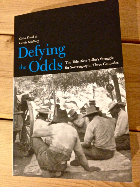
When considering Native and non-Native relations in the United States, it is first necessary to remember that the history rests on the foundational principal of sovereignty, or the ability of Native America to exercise autonomy within a defined geopolitical border. To varying degrees and throughout time, Federal and State governments have contested the sovereignty of Native America, and this is a topic anthropologist Gelya Frank and legal scholar Carole Goldberg cover in Defying the Odds: The Tule River Tribe’s Struggle for Sovereignty in Three Centuries (Yale University Press, 2010). Near the beginning of chapter 3, Frank and Goldberg give a concise paragraph description of the Tule River Tribe in the mid-nineteenth century:

After a brief but devastating war started by settlers in 1856, the Tribe was settled on the first Tule River Reservation located on the site of the traditional Koyeti tribe village. The federal government failed to secure this land and twenty years later forcibly removed the Tule River Tribe to its present reservation in the mountains. In 1886, a tribal council ordered the execution of an Indian on the reservation to reassert order and authority after the death of the Tribe’s recognized leader. The United States government, which indicted the executioners for murder, could have chosen to respect this act of community protection and social control. Judge Erskine M. Ross had an available legal theory that could have allowed him to dismiss the charges and let the four Tule River defendants go free. Under a theory of the Tribe’s “concurrent jurisdiction,” Judge Ross could have found that the execution was not a criminal act, even though Congress had passed the Major Crimes Act. (Frank & Goldberg, 2010: 67)

Judge Ross could have, but he did not. Before embarking on the specifics of this three hundred year struggle that the Tule River Tribe — a First Nation of America and the Western Hemisphere — has had with European and Euro-American nation-states, it is worthwhile to lay out two elements of political philosophy. The first is what is traditionally meant by sovereignty, and the second is the specifics to the 2007 United Nations General Assembly’s Declaration on the Rights of Indigenous Peoples.

The Tule River Tribe's ancestors and map illustration. (Frank & Goldberg, 2010: 23)

The Tule River Tribe’s ancestors and map illustration. (Frank & Goldberg, 2010: 23)

In political philosophy, a broader definition of sovereignty ensures that the sovereign nation is not only defined, but that it is recognized by other sovereign nations. Within each individual nation, sovereign people are able to define and govern themselves, speak a desired language, rejuvenate the culture with its own forms of religion or spirituality, develop its own economic resources, and defend themselves from harmful outsiders and nonmembers. In the case of the Tule River Tribe, they have always had this internal sovereignty, but the Euro-American nation and state has not always recognized it. This is why the focus of Defying the Odds resides on uncovering the internal sovereignty of the Tule River Tribe, or agency, and focusing on how the tribe has, in the words of the authors, “relied on its inherent cultural sovereignty when its externally recognized political sovereignty has been weakened or compromised by the dominant federal and state governments.” (Frank & Goldberg, 2010: 5-6)

For those who are not a-historical, it is easy to understand that unrecognized or challenged sovereignty throughout history has resulted in war, genocide, ethnocide, and the dislocation of indigenous — and non-indigenous — groups throughout the world. This is why the United Nations in 2007 issued a Declaration on the Rights of Indigenous Peoples that made it illegal for indigenes to be subject to forced “action aimed at or affecting their integrity as distinct peoples, their cultural values and identities, including the dispossession of land, forced relocation, assimilation or integration, [and] the imposition of foreign lifestyles and propaganda.” This declaration does more to recognize the collective rather than individual human rights, but it does this so that the defined and defended collective can internally navigate the individual rights of the domestic populace. (Frank & Goldberg, 2010: 6-7)

Frank and Goldberg define sovereignty in a national and international context. In the history of the United States, the Federal and state governments have persistently asked Native America to not only articulate its sovereignty through a legal framework (through treaties and legalese), but also with a romanticized ideal of expected aesthetics. This simply means that non-Natives often want Natives to “look” Native, and if they do not achieve the expected aesthetic, they are somehow no longer authentically Native. Speaking to this, the Lakota scholar Philip S. Deloria noted how the United States holds Native America’s inherent sovereignty to a much different standard than non-Native America. Deloria says the United States does not audit “the demographic status of all the little countries in Europe that are frequently compared in size and population with Indian tribes,” and that “No one asks whether Monaco and Liechtenstein are sufficiently culturally distinct from neighboring countries to justify their continued existence.” The ethical and philosophical point of this remark is impossible to ignore. If representatives of the Monaco or Liechtenstein governments did not show up “looking” like they were from Monaco or Liechtenstein, the United States government would not use this to undermine the sovereignty of Monaco or Liechtenstein. This has not been the historical case throughout Native America and, particular to this study, the Tule River Tribe. (Frank & Goldberg, 2010: 13)

The history of the Tule River Tribe is divided into two segments, particularly what happened before and after the 1888 court case, United States v. Whaley. In the case, United States Judge E.M. Ross favored the U.S. Major Crimes Act of 1885 rather than established tribal sovereignty. In the events that lead up to the 1888 case, Tule River tribal members Salt Lake Pete, Bill Whaley, Pancho Francisco, and Juan Chino ordered the internal execution or capitol punishment of their shaman who was accused of killing the tribe’s Yaudanchi tiya, or chief, and 12 to 20 other tribal members. During the court hearing, though, U.S. Judge Ross favored the Major Crimes Act, a Federal law that prohibited one Native from killing another on a reservation — again, a Federal Act that attacked tribal sovereignty by undermining the sovereign tribe’s ability to take care of its own domestic issues. In essence, the Major Crimes Act criminalized tribal authority and sovereignty. Frank and Goldberg chart how the Tule River Tribe has remained culturally distinct from 1885 to the present, no easy task considering later policies aimed at forced assimilation and relocation.

The Tule River Tribe location in California.

The Tule River Tribe location in California.

This work of scholarship is important to Historians, Public Historians, World Historians and Legal Scholars for several reasons. The first is why it is necessary for scholars to understand the historical origins of political philosophy, specifically the notion or notions of sovereignty, and how the definition changed in a variety of ways within distinct cultures. In the Western world, absolutist monarchs developed some of the first notions of sovereignty. In subsequent centuries secular and Enlightenment colonists altered the definition but retained the word. By the late-nineteenth century, though, Euro-Americans, and particularly Anglo-Americans, developed increasingly strong notions of Social Darwinian or racist thoughts, and they obsessed over domestic and foreign nation-making. This nation-making favored a strong, sovereign arm of the Federal government that rallied around an imagined and common “race.”

This brings up a secondary interest in Frank and Goldberg that speaks to nineteenth century international law, specifically extraterritoriality, which exempted individuals from the jurisdiction of local law. Much in the same way that the Great Powers of the West — Great Britain, France, Germany, the United States — planted their own overlapping versions of jurisprudence in areas they colonized — throughout the Ottoman Empire in North Africa and the Levant, and in places such as Hong Kong, China — so too was the United States engaged in planting the strong arm of Federal jurisprudence in Native America. World Historians, Historians and Legal Scholars (I am capitalizing these professions for some reason) would benefit in understanding these 19th-century processes. In the case of the Tule River Tribe, Public Historians can increasingly consider how a cultural landscape, the Tule River, is linked to an ethnicity much in the same way that a Euro-American with, say, the surname Bergstrom, was at one point in time connected with a mountain stream (“Bergstrom” in many northern European languages is directly translated as Mountain Stream).

Where these considerations will lead is unknown, but the world’s population in the 21st century still carries cultural baggage that originated in and before the 19th century. As well, when a-historical politicians in the 21st century bemoan the “problems” on reservations, the onus is on the historians, anthropologists and legal scholars to point out how the Euro-American colonization of America waged genocide and ethnocide on Native America and disrupted indigenous sovereignty, the political and humanist philosophy that allows a people and culture the spirit and self-determination to breath and live.


Thinking About a History of Strip Mall Culture

Strip Mall culture. Is this a sub-suburb of Denver, Colorado, Bismarck, North Dakota, Bloomington, Minnesota, or Las Vegas, Nevada?

Strip Mall culture. Where am I? Is this a sub-suburb of Denver, Colorado; Bismarck, North Dakota; Bloomington, Minnesota; or Las Vegas, Nevada?

I’m currently about to leave a sub-suburb of Denver, and while sitting in the strip mall complexes I couldn’t help but psychologically lapsing into thinking I was for a moment in north Bismarck or West Fargo, North Dakota, or a suburb of Minneapolis, Minnesota, or somewhere in Las Vegas, Nevada. Then I began openly wondering and considering how a scholarly history of Revit might help us, today, grapple with the homogeneous aesthetics that we wander and wonder around in. It no doubt is a reflection of the post-WWII industrial consumerism (and the democracy of stuff) that we were all born into. And this is why history is important, at least so friends, colleagues and family can help one another understand the deep backdrop of our horizontal and vertical strip mall culture.

I need to do further research on this, and chat with professors of engineering and architecture as well, but it seemed decent to get some thoughts together on this here blog. Also, it is not only the United States engaged in a Revit, strip-mall matrix, but the entire globe. For example, the video short below is of a small Hutong neighborhood in Beijing, China, the types that the government is increasingly sweeping away in the name of strip mall modernity. I think that frustration could be mitigated in 2013 if we at least had a body of historical scholarship that showed how horizontal and vertical strip malls came to be. Only when we know our past are we able to figure out what we need to react to, or what new directions to push in. But enough of all this. Here is downtown Beijing.


Notes from the WSSA Conference in Denver

Tom Isern at right listens to his student of history, Aaron Gutman, deliver his paper on the microhistory of three Prussian soldiers mustered into the US Army in 1862 to help with the defenses at Fort Abercrombie, Dakota Territory.

Tom Isern at right listens to his student of history, Aaron Gutman, deliver his paper on the microhistory of three Prussian soldiers mustered into the US Army in 1862 to help with the defenses at Fort Abercrombie, Dakota Territory.

It is now Saturday evening and I am finishing up another robust Western Social Science Association conference, this time in the Queen City of the Great Plains that is Denver, Colorado: a cosmopolitan cattle town and gold mining stop at the edge of the Great Plains and the Rocky Mountains (it was in this location that in the second half of the 19th century, south-north moving cowpunchers and cattle trails intersected with the east-west moving overland settlers, miners and pioneers). This morning Aaron Gutman (North Dakota State University) delivered his paper, “The Siege of Fort Abercrombie D.T. 1862 and its Global Connections,” emphasizing the ethnic make-up of three German-Prussians commanding the cannon battery for the US Army during the siege at the fort in late-August and through September of 1862. Gutman was apt to point out that the Prussian immigrants mustered into Civil War service were experienced with street fighting, having come from the renegade and liberal streets of the German revolutions of 1848. I also had a great time listening to Alex Steenstra (Northern Arizona University) and Christine Cheyne (Massey University, Palmerston North, New Zealand) talk about the Mighty River Power struggle between the Maori and the New Zealand Crown, and the fracking going on today in New Zealand.

Mexico City in downtown Denver, Colorado.

Mexico City in downtown Denver, Colorado.

Yet as historians, archaeologists, humanities folk and social scientists considered what happened and what is happening in great detail at these conferences, we also take account of our contemporary surroundings. This includes food, music and drink. So a quick run-down of some of the dining establishments visited during this professional conference include the spectacular Biker Jim’s hot dog joint (I had the delicious duck-cilantro dog), and the restaurant Mexico City, both in one of Denver’s historic districts. There was some Thai place that we visited too (the name escapes me, but I have found inspiration with the lemon grass coconut soup, and will be bringing the general recipe idea back to the northern Great Plains). Of music, I got to see the Tejon Street Corner Thieves belt out some street-level blue grass, and I purchased one of their DIY CDs for the street-level market price of $5.00. Of drink, there is an infinite amount of barley pop varieties to try, and I have taken to the stuff in the can — an archaeologist friend of mine in Missoula calls these “canned goods.” But I better wrap this up because the 55th Annual Western Social Science Association conference reception begins in less than 20 minutes.


Revisiting Dee Taylor’s Archaeology of Roosevelt’s Elkhorn Ranch

A view of the Elkhorn Ranch landscape from October 6, 2012.

A view of the Elkhorn Ranch landscape from October 6, 2012.

Some years ago, perhaps around 2008, friend and colleague Lou Hafermehl asked me to join up with him in research and a study that sought to look at the landscape history in and around Theodore Roosevelt’s 1883 Elkhorn Ranch in southwestern North Dakota. For a variety of reasons, our project came to a halt (the decision above our pay grade, as most if not all are), but prior to that, I had come across perhaps the best modern archaeological investigation of a “man camp” in western North Dakota: the Dee Taylor’s study of the Elkhorn Ranch. Arguments can be made back and forth as to whether the cattle ranching industry in the late-19th century was in fact an industry with man camp associations. I would argue yes, since it involved a clear boom-bust cycle, over-crowded and over-grazed grasslands, punishing winters, heavy speculation, and industrial railroads that attempted to bring the cattle to markets in Chicago and beyond. Actual cowboy open range cattle ranching was a short-lived event in American history, and perhaps this is why it is so heavily romanticized: it came and went like a flash in the pan (barb-wire fencing ultimately brought an end to those pesky open grazers).

The layout of the Elkhorn Ranch home in Dee Taylor, "Archeological Investigations of the Elkhorn Ranch Site" (1959), 49.

The layout of the Elkhorn Ranch home in Dee Taylor, “Archeological Investigations of the Elkhorn Ranch Site” (1959), 49.

The 1959 archaeological investigation at the Elkhorn was conducted by Dee C. Taylor (Montana State University), and it is titled, Archeological Investigations of the Elkhorn Ranch Site. Without going over the 146-page report in detail (at least not here), I thought I’d mention at least one of the pieces of material culture that the archaeological crew recovered from the Elkhorn Ranch house. In reading through the domestic assemblage, my eyes focused on the label of one of the tins recovered that said, “OYSTERS.” The three individuals out at the Elkhorn (Theodore, but more so Bill Sewall and Wilmot Dow) were from or around New England (Sewall and Dow served as hunting guides for Roosevelt in Maine). One can imagine that they would get a bit lonesome for some culinary semblance of home, and tins of oysters might have filled that void. Or they could have simply been hungry for food, and a tin of oysters was what they had to eat.

In today’s man camps of western North Dakota, at least the multi-national corporate Type I camps, the kitchens openly advertise southern style cooking, likely to draw the attention of any number of oil laborers from the Gulf of Mexico region. So in thinking about this in a comparative studies kind of way, one can say that in the 1880s New England ranchers devoured oysters at the Elkhorn Ranch site along the Little Missouri River, and in 2013 oil laborers from the Gulf of Mexico area are now on the northern Great Plains, inhaling canteen-style southern cooking around Tioga, Alexander and beyond. This is archaeological food for thought before I head to Denver to present my paper at the Western Social Science Association on the modern archaeology of man camps in western North Dakota.

Note: in his introduction, Dee Taylor noted that he took two anthropology grad students along on his excavation crew, William G. Buckles and John J. Hoffman, and other crew members included Arvid Scott, Rodney Myers, and Vernon Goldsberry. Be very suspicious of any historian or archaeologist who does not mention anyone but themselves as researchers, writers, and idea-generators.


US-Dakota Wars, Then and Now: Ellendale, North Dakota, April 5, 2013

1862-and-2012Last night in Ellendale, North Dakota (not far from a September 1863 massacre site of memory and mourning that is Whitestone Hill), a panel discussion between Natives and non-Natives took place at the Ellendale Opera House. The discussion opened with introductory remarks by North Dakota State University’s Tom Isern, and then by philosopher of ethics, Professor Dennis Cooley (Dennis is co-founder of the Northern Plains Ethics Institute, linked to here). From there Richard Rothaus provided an overview of the US-Dakota Wars that started in the Minnesota River Valley, 1862, but did not end in Mankato with the largest execution in United States history. In the following years, the US engaged in a protracted punitive campaign against all Sioux, regardless of whether they participated in the US-Dakota Wars throughout the Minnesota River Valley in 1862 — the many were punished for the actions of a few.

I think one of the main reasons folks came to this — and they expressed it — was to listen to what Tamara St. John (Sisseton-Wahpeton Oyate, South Dakota) and Ladonna Brave Bull Allard (Standing Rock Tourism Director, North Dakota) had to say. Toward the end of the conversation, several of the Ellendale residents expressed immense thanks for the opportunity to listen, and one individual said they will use this panel discussion to navigate how to go about organizing the 150th year event at Whitestone Hill this September.

The US-Dakota War Panel Discussion from April 5, 2013, in Ellendale, North Dakota.

The US-Dakota War Panel Discussion from April 5, 2013, at the Opera House in Ellendale, North Dakota.

To solidify our imagined sense of geographic history, I thought that it might be helpful to circulate the following map above that situates Native America on the northern Great Plains circa 1862, and contrasts it with the 2013 Eisenhower Interstate system. Also, linked here is a audio recording of the panel discussion in Ellendale, North Dakota, from April 5, 2013, taken by Kenneth Smith. The entire event was sponsored by the North Dakota Humanities Council and the Center for Heritage Renewal.


Winter Driving in the Oil Patch of Western North Dakota

North Dakota Highway 85 on March 23, 2013.

North Dakota Highway 85 on March 23, 2013.

On March 23, 2013 (a Saturday), I drove west on I-94 from Bismarck, North Dakota to the Belfield exit, then turned north on Highway 85. My goal was to make it up to Watford City to take in a discussion on the Dakota Wars, post-150 years. The previous evening the discussion was held at Sitting Bull College, and I attended that one too. But after driving on Highway 85 that early afternoon, at least after 20 miles of it, I decided to turn around and head back to Bismarck. The wind carries wisps of snow over the road, and it barely melts, and then freezes. In the afternoon, the roads were a kind of icy-slush, and my plan was to attend the discussion that started at 7pm, and then head back to Bismarck around 9pm. The temps would drop, and the icy-slush would turn to straight-away ice. In both academic and lay-person parlance, driving at night on these roads is what we would have called a “really, really dumb idea and follow through.” So on the afternoon drive up, I eventually pulled over at a safe place, called ahead to Watford City to inform the group that I had a change of plans, and then turned around and headed back to Bismarck. Before turning around, though, I captured an audio-video short of what the roads were like, a kind of cross-section of what western North Dakotans and oil laborers (they are increasingly the same thing) are exposed to each and every day.

In the audio-video: to the right a pick up is driving in the ditch after having just slid off the road while in the left lane oil trucks whip by in the opposite direction. Stay safe out there folks, and don’t let yourself or crazed bosses or market forces hurry you any quicker than you need to be going. Remember this: the oil isn’t going anywhere, and it will be there tomorrow.

An aside: in driving from Sitting Bull College to Bismarck, and then in an attempt to make it up to Watford City, I couldn’t help but thinking about how certain North Dakotans will sometimes in a very judgmental tone say, “Look at all these people coming into our state!!… Do you think they will stay?” And then thinking after that how in the 1860s and on Native elders may have said the same thing about our arriving non-Native and Euro-American great-great grandparents and great grandparents. Then I start thinking about how population movements throughout world history have almost always been chaotic…